Monday, January 22, 2007

The Great Canadian Motorcycle Trek


http://www.motorcycletrek.ca/onTV.html
The Great Canadian Motorcycle Trek is a 13 week, half hour episode about 3 riders crossing Canada in 30 days.

National Parks


http://www.nps.gov/parks.html

Video Clips

http://www.youtube.com/watch?v=W6N2R5PV6b8


Video
http://video.google.com/videoplay?docid=6178043709180164205&pr=goog-sl

http://www.zippyvideos.com/197881770396015/crashes_-_motorcycle/
">
Description: What happens when you're foolish, and lack the basic sense of fear. this is a short clip of someone doing a front flip with their motorcycle off a ramp. Needless to say, it ends up in a pretty spectacular crash

This is AWESOME.. I think they are riding smaller VFR's but I have never seen anyone handle a bike like this... It's like ultra tight motorcycle autocross!
http://video.google.com/videoplay?docid=6178043709180164205&pr=goog-sl


http://www.zippyvideos.com/197881770396015/crashes_-_motorcycle/

Following to close!

http://video.google.com/videoplay?docid=-9163595449705820423&pr=goog-sl
Crazy illegal speeds, the video camera is strapped to the gas tank, bike is in speeds up to 300 Kilometers!

Sunday, January 21, 2007

http://actualriders.com/


http://actualriders.com/
Four wheels move the body. Two wheels move the soul.

There’s a Quality in riding a bike that transcends all lines: age, economics, country, gender, and reason. It doesn’t matter what you wear, what type or color of bike you ride, or where you go. We all know what it is, we all share it. Rational words can’t describe it; it’s what you ‘feel’ inside you and around you.

ActualRiders is a group of folks who share this quality of riding. We share it online through this website and associated elements. And we share it in real life during local, regional and continental meets and group rides. We hope to continue annual rallies in places that inspire us to keep riding and sharing those rides with others. Remember, it’s not just the goal, it’s the journey.

The ActualRiders website and forum offer a central online interface for members to share discussion, events, news, technical matters, travel logs, and ourselves. As the group expands, the website interface will evolve. So check back for updates and news.

We welcome all riders who share our enthusiasm for riding and we hope you will join us on our journey.

Wednesday, January 17, 2007

proto call patch placement


Encyclopedia

Encyclopedia> http://en.wikipedia.org/wiki/List_of_overviews

The most common type of motorcycle accident
is caused by inattentive drivers making a turn directly in front of a motorcycle.

The two major causes of motorcycle accidents in the United States are (1) motorists pulling out or turning in front of motorcyclists and violating their rights-of-way, and (2) motorcyclists running wide in turns and crashing.

Welcome to Wikipedia,
the free encyclopedia that anyone can edit.
1,586,831 articles in English
http://en.wikipedia.org/wiki/Wikipedia

Monday, January 15, 2007

Welcome


Welcome to Live to Ride, the best place to follow Darel’s travels, traveling the back roads of northern California or hitting the expansive Hwy’s to oregon, Idaho, & Washington. Personal notes, travel journals and photos are here for your enjoyment. As always, feedback and comments are appreciated and the occasional constructive criticism will be tolerated.

Most of my motorcycling travels can be found under "touring".

Posts are grouped in Categories & Labels:

Labels:
CMA
Pack wisely
photos
maintenance/wrenching
misc.
pipes
Safety tips
Scenery Pictures of USA
Total Control
touring
TV
video
welcome
Westword Riders

Pour yourself a beverage, sit back and enjoy taking a journey with me. Hopefully you’ll be inspired to go on your own adventures and make memories that you can cherish for years to come.

http://cruiserlivetoride.blogspot.com/

http://dabbott-bullardsbarloop.blogspot.com/
Yahoo 360degrees- darelabbott
blog-_wWZIZM1erTGA9hnw0UfXcVbdg--;_ylt=ArhqC8RfVrER1.htm

Seattle, WA to Fortuna, CA


Seattle, WA to Fortuna, CA
May 18 - 22, 2006
Total Miles: 1,623
Map 2b:
West Coast Regional Meet III
We took the coastal views of 101 south of Crescent City, passing through the little burbs of Orick, Trinidad and Moonstone. We cruised through Eureka, our hosts’ hometown, and continued the last 15 miles to Fortuna.
I had already decided that I wanted to ride the Lost Coast road – a seventy-mile route that I was rumored to hold not only amazing coastal scenery, but also terrible, potholed roads.
Then the ocean appeared. I rounded a bend and suddenly it was there. I don’t know how the world’s largest body of water can surprise me, but it did. The road surface became flat and smooth and fast. The sportbikes were in their element, spinning the speedometer needle around the instrument face. I myself wasn’t looking for speed. Instead I studied the grassy hillsides, the rolling waves and the languor of the cows in the fields. I stopped for photos of the wild flowers and to catch some fellow riders in action as they zipped by me. The rocks offshore held birds and seals and other, smaller, unseen creatures. The sky was almost blue and the wind whipped in from the ocean’s vast surface, giving life to the tall grasses nodding in unison. This was what it was all about. It had nothing to do with the miles but instead all about the experience. This was here and now and this was living.


It is only for a few miles that the Lost Coast road actually follows the coast before diving inland again. But when taken from north-to-south, the “dive” inland is much more like an ascent. Or, more accurately, an assault. It’s an 18% grade that takes you up like a roller coaster ascending the first hill in an amusement park. With a sharp turn at the top just to make things interesting. From this point on the Lost Coast was all inland roads, snaking up hillsides and rolling along ridgelines. The roads were narrow and slightly better maintained than through the redwood forest but they were still challenging to ride on. Our group scattered, and as we got closer to our destination the photo stops decreased. Only a couple of us bothered to stop in the picturesque town of Ferndale, taking in the beautiful restored and maintained Victorian buildings. From here it was a quick trip to Fortuna and our second group dinner. And this time I would not only be on time, I would be early!
The return North trip:
When we reached Willow Creek we made the decision to keep going east on 299 instead of north on 96. I kept hoping that if we headed further inland then the clouds would part and I’d be basking in the warmth of the sun with dry roads passing beneath my tires. It wasn’t to be. The sun played peak-a-boo for a while and I was tired. I relished the thought of finding a quiet pull-out along the Trinity River where I could park the bike, lay down on the grass and close my eyes for 15 minutes. No sooner had I mentally drawn out that thought then the clouds thickened and promised another dousing. We reached Weaverville and I knew that the road would get very technical between here and the interstate, something I was not looking forward to in my mental state and with the impending rain. As an alternative Doug and I consulted the maps and saw that 3 ran north of Weaverville, following the shores of Trinity Lake before joining up with the I-5 at Yreka. We chose to take the unknown northern route along the lake.
The rain started almost immediately, drenching the roads as I led us along unfamiliar territory. The road was in good shape and there was no traffic to impede us. I took the turns fast considering that they were wet and new to me. Doug followed along behind, trailing me like a hound dog “gone to ground”. The lake was almost deserted on this rainy Sunday, the glassy surface broken up by a gentle breeze and drops of rain. We followed the Trinity River north for quite some time, enjoying the wide, volatile riverbed that dominated the valley. The road veered suddenly from the lowlands and immediately rocketed my bike upward, twisting its way through tree-covered slopes. I spied a waterfall at one bend and pulled to the side to investigate. There was a scattering of snow nestled among the trees and the river was a raging torrent, hurtling down the mountain like an angry lion. We got back on the bikes and the road immediately turned back on itself. It snaked up the side of the mountains, a wet serpentine ribbon of pavement that switched back and forth, climbing into the clouds. There were occasional rocks and pine cones in the road, and of course the continuing rainfall, so I once again took an easy pace.
There isn’t much to say about the ride from wherever it was we stopped and into Seattle. It was the same interstate we rode down a few days ago and little had changed. The rain continued to haunt our journey and traffic kept things interesting.

Sunday, January 14, 2007

pine needles


Seattle - Fortuna - Seattle
May 20-23, 2004
Total Miles: 1,500
Seattle - Fortuna – Seattle
http://www.dantesdame.com/04wcrm.htm
Rt 47 When 47 crosses over 26 and heads to Rt 6 west it flattens out considerably, but does not remain so for very long. The road winds up and down and around and keeps things interesting. There isn't much civilization around, nor traffic. It was a very pleasant - if not overcast - ride to the coast.
We hit the coast at Tillamook and headed south on 101 where Todd took the lead and showed us a nifty little "Scenic Bypass" - the Road of Doom for me. It turned into a tight one way, one lane road tucked between 101 and the coast.
I was down to 20mph when I hit the second right - a decreasing radius right. I leaned into it but I wasn't cornering fast enough. I leaned some more, noting the approaching pine needles (remember that this is a one lane road - there wasn't even a centerline to cross if I wanted to). I leaned some more, telling myself that I had to trust that the bike could do it. I leaned some more. I leaned some more and whoops! - there goes the bike out from under me. The VFR slid maybe 20' along the road and into the grass shoulder before catching on something and flipping completely over onto the left side. I slid a bit on the pavement before hitting the grass and tumbling a couple of times and coming to rest on my back.

Hindsight
I do wonder what would have happened if I kept the peg dragging and didn't pull it up to scrub off speed. Would I have made the corner because I didn't lose the distance from standing the bike up? Or would I have just leveraged the bike up onto the peg? I don't know the answer, but I don't think that I made a really bad decision. I knew that I couldn't try and ride it out off the road. I feel good that I pushed the bike and that it gave out before I did. If there is anything that anyone else can see that I could have/should have done, please share. We can all learn from this I'm sure.
As a side note, I didn't feel that I was really pushing myself too hard on this road, but I did notice on the initial left-hander mentioned that I wasn't completely comfortable. I should have backed off right then, but there wasn't a lot of time between that thought and the Corner of Doom.

We continue down I-5 to Grant’s Pass and then the follow 199 to 101 and down the coast to Fortuna. We made a brief stop in Grant’s Pass for a bite to eat and enjoyed the appearance of the sun. The weather continued to improve as we neared the coast, with some damp areas in the tighter sections of 199. Eventually we hit the coast and were just in time to see the sun set into the Pacific. Not that it was a grand sunset as we were still plagued by a few clouds that marred the view. As the sun set and twilight descended we kept going and pulled into Fortuna at 10:30 that night, after 14 ½ hours on the road.

May 20-23, 2005
Total Miles: 1,500
Seattle - Fortuna - Seattle
From Eureka we headed north to 299 where the road quickly climbed into the hills above the coast. The sun had peeked out at breakfast but now it was again being obscured by clouds. It sprinkled just enough to wet the pavement but soon we had climbed high enough that we were in the clouds themselves. The fog was thick and I had difficulty seeing the cars around me so I reduced my speed until we started to descend on the other side of the ridge and came back to blue skies and sunshine. We fueled up at Willow Creek and then headed north on 96, an excellent motorcycle road that hugs the sides of the mountains and twists more than a snake in a mongoose’s grasp. The sky was clear, trees were green, rivers were high and the pavement was perfect. Our GS’s took corner after corner in perfect unison, the bikes falling into the corners with a rhythm that was almost mesmerizing. We paused at a unique bridge over the Klamath River to take in the beauty that was around us and then mounted the bikes again to head for Happy Camp. Once there we continued on 96, heading east towards I-5 and continued our ride under the sunshine and blue sky.

Eureka to Yreka
Eureka for home. I could attempt to describe Route 96 from Willow Creek to Happy Camp and then on to Yreka, but no amount of words can fully convey the sense of freedom and pleasure I get from these 145 miles of corners, bends, twists and turns. The road surface is always good, the views are always spectacular, the temperature is always perfect and the traffic almost nonexistent. Each time I turn the bike in for a corner I know that there will be another one waiting for me. There are sections of the road where the painted lines weave back and forth, causing the GS to flick from one side to the other in rapid succession. I am by no means a fast rider, nor do I usually demand high performance from my bikes, but this road lets me ride at a quick yet comfortable pace. I am sometimes pushing myself in the tight turns etched into the rock wall of the canyon while other times I am letting the bike fall in gracefully through a well cambered, perfect radius corner, all the time the pavement is following the snake-like progress of the Klamath River. The road is tucked into the wide canyon of the river, sometimes running deep alongside the water’s edge, other times coming up for air and soaring above the rushing rapids. I could ride this road all day. But each day must end and I eventually came to the end of Nirvana. It is called Yreka.
http://mapshare.delorme.com/Consumer/V.aspx?p=bd0w15r6

Seattle, WA – Custer, SD – Seattle, WA


the story of a life-changing journey!
http://www.dantesdame.com/03custer.htm


June 2003
Total Miles: 5,600 miles, 11 days
Seattle, WA – Custer, SD – Seattle, WA

Via - U.S. 12 Lewiston-Missoula, Lolo Pass, One of the most famous roads in motorcycling. A nice ride up and over the Bitterroot Mountains, part of Lewis and Clark trail, 77 miles of twisty ribbon. The curves are mostly sweepers, but as you approach Lolo Pass the intensity picks up.

Seattle, WA to San Francisco, CA and back


Seattle to Walnut Creek/San Francisco
http://www.sport-touring.net/forums/index.php/topic,1403.0.html
July 23-29th, 2003
Total Miles: 2,420, 7 days

Any other hobby has a certain point where one can lose interest for a while, but with motorcycle journeys, it's very different. Our sport is always changing. You can ride the same road twice and it would be like you had never been on it before. The weather, the direction of travel, the time of day; it makes each journey different, even if you've done it a 100 times.
http://www.dantesdame.com/roadtrips.htm

Friday, January 12, 2007

Stranded


Stranded


I struggled all afternoon with what I really should do. On one hand, I had come this far and it would be a shame to not make it to the race. On the other hand, going farther from home in these conditions would be extremely foolish. I may very well make things worse by being stranded 1000 miles away from home instead of 650 miles away. At about midnight I got dressed and went out to the 640. I stood there for a few minutes contemplating whether I should go for it or not. I then changed my mind and went back to my room and got undressed. This same series of events repeated themselves about 6 times until early Saturday morning. I just couldn’t pull the trigger on getting farther from home. Somewhere in the back of my mind I knew it was foolish and the adventurer in me failed to act. I fell asleep around 0400.
http://www.sport-touring.net/forums/index.php/topic,756.0.html

Monday, January 08, 2007

Maps & notes

Maps & notes
(reprinted w/o permission, as referenced @ URL: http://www.bamarider.com/Favorite%20Roads/West/oregon.htm)
My map and notes. I don’t like anything on my handlebars, interfering with the lines of the bike. Besides, I like writing my routes down using the big picture only a map can give. My atlas allows me to see ALL the roads in the 500 miles between here and there. Studying routes and making notes gives me a feel for the land I’ll soon be in. Towns, elevation and landmarks are easy to see, and prepares me for the next day’s ride. What I CAN see doing, is researching routes from the atlas, and once the decisions are made, inputting them into a GPS device. But there is something romantic about the hand written notes on my left arm; I’m often asked about it.

California SR 96, The Klamath River Road - THE sport riding road of all time in my opinion. Anything you want can be had. Switchbacks? All you want. S's? This road is like spaghetti, Low traffic? Don't worry. Hairpins? More then a beauty salon. Length? Over 150 miles, almost 200 if you continue on SR 299. Oh yeah, and scenic.

California SR 108 - Perhaps the most scenic road I've ever been on. The road to Sonora Pass. Beautiful scenery. Snow was piled high as I worked my through the Alpine forest. Crystal clear water seemed to be flowing everywhere. Excellent pavement ruled the day. Prepare yourself for a long uphill run, and after reaching the crest, an equally long downhill. Traffic was not a factor the day I was there. Lots and lots of good curves.

California SR 70
- The Feather River Road. A nice road through the Feather River Canyon. Much of the road feels as if it was cut into the bluffs. As a rider leans the curves of 70, the water of the Feather River follows him. Many times I could see the road down below me, as I negotiated what seemed liked hundreds of U curves. It was a lot of fun and only had to pass a few cars.

California State Route 49 - I discovered this route in 2005. I ran it south to north. Traffic was a nuisance in the southern portions, but after clearing Auburn it thinned out and the highway became very technical. SR 49 can be intense and a few miles later relaxing. I enjoyed the many gold rush towns it passes through, on its way to Yuba pass. Pavement surface is good for the most part, and the vistas are excellent when the route turns into the Sierras. A good ride in through the Gold Country.

California SR 36 - I continue to whittle away at the roads in the Pashnit Site. SR 36 is in the top 3 roads of all time. Great curves of every type. Switchbacks, sweepers, sharp cresting hills. The route is 130 miles from the coast to Red Bluff over the mountains. Good scenery, lots of challenge, little traffic. One thing I can't figure out is how so many roads in the Hotel are void off traffic, given the number of people living there-not that I'm complaining. SR 36 is what I call a destination road, meaning its worth a 2,000 mile slab ride just get there to ride it. Some of the pavement is choppy at the high elevations, and look for Caltrans to have sections under construction especially near the mountains peaks. What a great road.

The Pacific Coast Highway, California Route 1 - Many lists start with this awesome road. Mine is no different. This road weaves and bobs along the California Coast, where the Mountains flow to the Sea, in a crashing white cap spectacle. You ride between mountains and water, amidst colors you will not find anywhere else. It offers challenging switchbacks, and hills. I refrain from serious sport riding on the PCH. I want to savor my surroundings. The PCH is unmatched in the east. The east coast of the U.S. is well developed, precluding any great riding. I long for the day I will return to this great highway. It is a road that must be ridden over and over to fully appreciate.

Oregon SR 86 - The route into Hell's Canyon.
It is my belief East Oregon is one of the most underrated areas of the country for riding, vastness, and challenging roads. This road has high elevation, anytime a highway rises the leaning is good. The route is also peppered with deadly drop offs, and steep climbs. The area is remote, and help could be a long way off. The route follows the Powder River when it comes down out of the mountains. Long sweepers stick to the river, and grows in intensity as you go in the mountains.

From Pendleton, Oregon, US 395 South -SR 74-SR 206-SR 218-SR 293 ending on US 95. In a connection of great roads these highways in Oregon offer some of the finest riding anywhere. Road surface is good, and so is the elevation. These highways are why we ride brothers. Lots of curves and twists, no intense switchbacks, but plenty of long sweepers. The landscape is farmland, and grassy hills, which translates into good visibility. Often you can look past the apex of the sweeper to check oncoming traffic and conditions. Frontier towns such as Fossil offer cafes for Mountain Dews, and good conversation.

Washington

The Palouse Ride- From Spokane, US 195 South-SR 271-SR 26-SR 127- US 12 south. This is a combination of roads. All are connected and the route easy to follow, covering about 125 miles. I love this ride through the wheat fields to Oregon. I have a certain affection for the Palouse, not many know of its timeless beauty and peaceful landscape. If you like twisties the routes will not disappoint, they are fun.

U.S. 97, Canadian Border to Oregon
- What a great road this is. Almost the entire length is good. In the north 97 glides you by the apple and other fruit orchards. Nice scenery. As you enter the central area mountains appear and the leaning is good. South from Yakima is my favorite, as you motor pass green rolling hills, and gentle sweepers. I truly enjoyed my time on this road, and think of it often.

Washington SR 129 - Near the Washington-Oregon line, lies one of the great roads-129. A remarkable stretch of asphalt between Oregon and Clarkston. The highway ricochets off the hills and sweeps up and down the mountains in one of the great slalom runs in the country. Falling rocks can be found in several sections so use caution. A fabulous ride on a good surface.


Montana

Montana SR's 28 and 200
- I combined these roads into one ride. Great riding. Scenic and twisty. Lots of elevation. Green mountains and clear streams guide you along these great roads. No traffic, in between the friendly frontier towns. In 2005 I picked the route back up near Missoula and rode it across the plains to North Dakota. A great ride past green buttes and pastures. A number of high speed run outs just for fun.

U.S. 12 Lewiston-Missoula, Lolo Pass
- One of the most famous roads in motorcycling, I don't know what I can add that has not already been written. A nice ride up and over the Bitterroot Mountains, the pat of Lewis and Clark, 77 miles of twisty ribbon. Pockets of traffic are common near Lewiston and Missoula, but don't last long. The curves are mostly sweepers, but as you approach Lolo Pass the intensity picks up.

Canada- Over the years I've had the good fortune of touring our neighbors to the north extensively. I've spent quality time in 8 of the 13 Provinces. A goal of mine is to visit all the provinces but not sure when it will happen. My quest to ride the lower 48 was much easier to do. The problem with Canada is vastness, and not all areas are easily reached. Add to the fact I have a long ride just to reach the border. Pocketing all the provinces may not happen till I come across a dual purpose bike. Western Canada is beautiful country, but to sample the full potential you have to leave the pavement. I can't afford to trash either of my Hondas on a all out assault on the Northwest Territories.
You can only go there in summer, and that means road construction, long stretches of it. In the meantime, I'll focus on the reaching what I can, and along the way I'm sure I'll add more roads to the list.


Provincial Route 132- This route is located on the Gaspe Peninsula, in Quebec. A scenic, inspiring highway. The road brings you up close and personal to the water. It has challenge but nothing drastic. Famous for its many fishing villages and pastoral farmland, it is true treat for the senses. The surface is not good in many places, so use caution. I rode it on a beautiful day, with farms on my right and gentle white caps on my left.

The Cabot Trail
- Getting here takes lots of work, but you are rewarded. The road surface ranges from good to terrible, but the scenery is consistently outstanding. The Cabot is the nearest thing on the east coast to the Pacific Coast Highway. Lots of good twists in the highlands. Don't ask me to compare the PCH and the Cabot, they are very different. The Cabot is more personal, and the water is prettier then the Pacific, but it does not have the smoothness of the PCH or the varied elevation and challenge.

Icefields Parkway- Located in Alberta, this is the ultimate highway for glacier viewing. The road itself is not especially challenging, but the landscape so gorgeous it has to be on the list. The land is very rugged and dense. I visited on a cloudy, rainy, cool, mid June morning. I would love to see this land under a clear blue sky. Most of the mountain peaks were over 10,000 feet and close to the road. The highway has a intimate relationship with the Rocky Mountains. Like most great highways in Canada, it is not easy to reach.

Long Distance Tips

Iron Butt Tips: (reprinted w/o permission in part as published @
http://www.ironbutt.com/tech/aowprintout.cfm ).
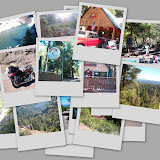
http://rocketbunny.blogspot.com/2007/01/lunch-ride-to-pensacola-ride-out.html


Pack wisely; keep personal supplies handy.

While many riders use a tank bag, what they pack in them is not always well thought out. Sun screen, skin lotions, eye cleaner, eye lubricant, a flash light, a tire gauge, maps and other essentials should all be kept in a handy location. If these items are not on-hand when you need them, you won't use them. That can lead to costly mistakes like missing a road because you didn't want to find your map or roasting your face and then facing painful sun burn for days into a trip (ever try wearing a helmet over a sun-burnt head? - do it once and you will never forget to pack the sun screen where it is handy).
On the other hand, things like registration and insurance papers should be kept in a secure water tight area of the motorcycle. Assuming you probably will only need these items while talking to the Law, having them stowed away gives you time to talk to the officer and convince him you are human and not some crazed-biker - that could work to your advantage.
Upgrade your tool kit. The tool kit in most motorcycles are at best junk. Use the tool kit as a guide and purchase quality replacement tools from Snap-On or Sears' Craftsman. Also add a compact digital voltmeter (Radio Shack sells a pocket model for less than $20) and a ratchet and socket set.
In May of 1997, the late, great Ron Major published to the LD Riders list what is undoubtedly the most comprehensive tool listing ever devised:


ALL:
In my leather Travelcade tool bag, 4 X 5 1/2 X 11 inches:
10 in. Channelock pliers
6 in. Channelock pliers
6 in. needle nose pliers
5 in. flush cutting wire cutters
5 in. wire strippers
6 in. locking surgical forceps
4 in. 1/8 flat blade screwdriver
4 1/2 3/16 flat blade screwdriver
4 in. 00 Phillips screwdriver
6 in. #1 Phillips screwdriver
7 1/2 in. #2 Phillips screwdriver
7 1/2 in. 1/4 in. flat screwdriver
Xcelite four way driver
Magnet, general use, small
6 in. Crescent Wrench
Short 1/2 - 9/16 in. open end wrench
M 10 X M 11 open end wrench
M 12 X M 14 open end wrench
M 10 X M 11 box end wrench
M 12 X M 14 box end wrench
M 17 X M 19 box end wrench
MAC combination six point Flex Box End/Open End, M 10, M 12, M 14, M 17 wrenches
4 oz. ball pien hammer, with handle shortened to 7 in.
M 5 hex key - short arm
M 6 hex key - short arm
M 5 Ball end hex key - "T" handle - 8 in.
Machinist's scribe, self storing point
6 Straight edge razor blades
6 C.C. tube of Locktite
6 Oz. tube of RTV clear silicone sealer
Two Tube 5 Minute Epoxy
Zip-lock bag of Anti-Seize Compound
Zip-lock bag of rear spline lube, Honda 60% moly paste (for rear tire change)
The two above items stored in 35 MM film containers, clean, dry, protected!
Top quality padlock - with keys
2 spare electric vest wire connectors - wired
12 feet of two conductor electric wire
35-40 small zip ties - 3 1/2 in.
12 medium zip ties - 8 in.
8 in. Tire Iron
6 electricians tapes, roll ends only, very easy to carry/use
12 Pre-Packaged alcohol wipes, for general clean-up
6 Pre-packaged "Handy-Towels" for your hands, etc.
clean up towels, terrycloth
ALL - Snap-On, Craftsman, Mac, Xelite, etc., PROFESSIONAL TOOLS!
Not In The Above Kit:
Stock ST1100A Honda Tool-kit
siphon hose, 5 /16 in. I.D., 6 feet long
1/4 in. Nylon rope, 15 feet long
12 in. Crescent Wrench
M 5, M 6 long arm, ball end hex drivers
Spare fuses for "EVERYTHING"
Re-chargable, 2-D Cell flashlight
AA cell Maglight, on neck lanyard, for walking bonuses/back-up
Two AAA cell Maglights
Eye glass repair kit
Sewing kit
Safety pins
Lensatic, Engineer Compass
2 Magnifying glasses, 2X, and 5X
Small mirror
Swiss Army Knife
Wavetek, DM78A Digital Multimeter
Digital tire gauge
Spare keys for "everything"
6 new Micro-Point ball point pens
MANY spare batteries for flashlights, clock/timers, shaver, Screaming-Meanies!
Buck TITANIUM locking blade knife, 3 3/4 in. blade
Spare headlight, driving light, license plate, and other bulbs
Spare throttle cables
These items are ALWAYS in my ST1100!
AND the MOST IMPORTANT ITEM:
The Skill, Knowlege, and Ability to use them!!!!!!!!!!!!!
Ron, well prepared, Major
P. S.
You should see my "First Aid Kit", and other necessary things, such as three different tire repair methods, and two means of inflation!
P. S. S.
We must have an un-scheduled "TANK BAG SHOOT-OUT" someday!!!!! Many eyes would be opened, for sure, if they saw what the "Old Timers" actually carried in their tank-bags!!!!! This is very private, and personal, like a LADY's PURSE!
My $0.50 worth.
- Ron Major

http://www.ironbutt.com/tech/aowprintout.cfm


Long Distance Tips
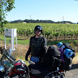
Camp gear - packing bike
Copied w/o permission as published @ URL: http://ridingtwowheels.blogspot.com/2006_10_01_archive.html

Aside from three pairs of socks, one pair heavy wicking and warm, the only other clothes were a set of cold weather UnderArmors. These are expensive, but they proved well worth the expense. They are extremely light and thin, warm, and wick away moisture from the skin very successfully. I slept in them the night on Mesa Verde when freezing rain, wind and snow bombarded me in the tent. They were warm and thin underneath my insulated riding gear and excellent for layering. The only days I did not wear them were 'off-the-bike' days and the last day on the road when temperatures were in the 90's. They wash up easily in the sink and dry quickly when hung.

All clothing went into Coleman Space Saver bags, much like Seal-a-Meal bags where the air can be compressed out the bottom by a one-way exhaust. These bags significantly reduced the volume of my clothes into two tightly rolled bags that fit very well into the side cases.

Nearly all the camping gear, including battery-powered portable air pump, went into two dry bags lashed onto the pillion seat. The only items in a side case were the mummy bag (in a compression bag) and the Big Anges inflatable pad. I was also able to store the insulating liners for my riding jacket and pants in the dry bags. My mesh gear, both jacket and pants, were in a horizontally compressed nylon bag also in a dry bag.

One of the dry bags and two sets of webbed straps with D-ring extensions were ordered from Helen2wheels. The cord-close dry bag accommodated all the tent components, including ground cloth, the portable air pump and one of the outer gear liners. The straps were a godsend. I will be ordering more of those and an extra set of the D-ring extenders; in bright yellow!

The dry bag contained the long compression bag of mesh gear, a folded Therma-rest pad, the Big Agnes sleeping bag, sleeping bag liner, and anything else that needed a 'home'. As you can see from the photo, the bright orange increases visibility; I also added a length of reflective tape on the black bottom of the bag.

Both bags were strapped to the bike in front of the Storm case with the webbed straps and one heavy duty bungee cord. A cargo net on top completed the attachment. When I stopped overnight without camping, I left these two bags strapped on to the bike and removed the laptop case and sidecase liners with contents. When camping, everything came off the top of the bike, but most of the contents of the sidecases stayed in.

An essential part of any journey, often a journey unto itself, is the preparation. Most previous posts describing preparing the bike are titled ‘The Continuing Education of Whee.’
Seat: The sheepskin pad from the cruiser was put on the seat to increase comfort and moderate temperature. And it is very successful no matter what the temperature: hot or cold.
Handguards: These are worth their weight in gold! I chose Probend guards on the recommendation of a KLR rider; they allow for ample room of hands and levers and have interchangable shields. They deflect the wind and rain, helping to keep the hands warm.
Electronic gadgets: Several of these are on my list: voltimeter, outlet for hand or vest warmers, and cruise control would be super! First order modification is installing a power distribution system before any other electronics are added.

GPS: I don't necessarily mind being lost, but it seems that getting lost at the wrong time was the rule. All four times were when I was pressured to ride to a destination quickly due to inclement weather conditions or encroaching darkness. Being lost at night is not fun.

These useful gadgets can also supply useful travel information such as riding speed, average speed, altitude, total mileage, average daily mileage, and so much more. It's like a miniature cockpit in a box on your handlebar.

Thoughts on the Road: Personal Grooming and Necessities:
A coffee cup is a necessity. Starbucks insulated mug that also serves as a small French Press. All one needs is coarse grounds and hot tap water. I did pack a washcloth and small hand towel. I discovered I needed lots of Chap Stick, and stuck a stick everywhere I could: in my camera case, tank bag, and hygiene bag. I also used a small miniature jar of facial cream, prolifically covering my face morning and night to ward off the drying effects of the sun and wind. Even then, my nose and lips burned and peeled through most of the journey. A tooth brush & paste. I also added a small tin of mints in my tank bag. Not only does it mask travel mouth, but it also stimulates saliva production reducing dry mouth. Liquids: one can never have enough of that. The Camelbac is the greatest invention; I can’t imagine a road trip without it. There is no way to accurately predict the weather, so I packed one item for cold and hot weather for the two halves of my body; jeans and fleece zippered jacket, T-shirt, tank top and shorts. By the time I reached Taos, I realized the tank top and shorts would not be needed, so I sent them back home. I spent most of my time on this trip in riding gear anyway, but I was thankful for the T-shirt and jeans when off the bike. I also packed my lightweight sandals, which I wore anytime off the bike to give my feet some breathing time and boots a chance to dry on the inside. Except for the last two days of this trip when summer reappeared, I wore the UnderArmors and
insulated gear. Clothing for off the bike was minimal.
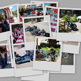
rocketbunny: Copied w/o permission as published @ URL: http://rocketbunny.blogspot.com/
I also bought a few new accessories for the road.
• Battery powered toothbrushes have really come down in cost. I picked up an OralB for $5. I used to hate the feeling of using a manual toothbrush when on the road, instead of my deluxe rechargeable. Now my teeth should be squeaky clean morning and night.
• Adapter cord for charging electronics. BMW uses a funky power socket, so while I have one built in on the bike, I couldn’t actually use it. Until now. I’m thinking that my old Giant Tank Bag ™ is going to get strapped to the rear seat and get used as a charging station for all my various goodies. With the ST’s giant saddlebags, the tent and sleeping bag should no longer take up seat space.
• I also acquired a cheap bullet camera for taking onboard video. I’m not going to hype it until I see how it does.
Loose Ends:

Among the stuff that will have to wait for last minute:
• Business cards with rocketbunny information to hand out to people I meet. I’ve been meaning to do this for a few years. I have a design in mind and the pre-cut cards to do it with. I just need to sit down at my graphics computer and do it.

• Refresh my ebook collection. I carry a Ipaq loaded with ebooks for night and meal reading. I usually load at least 5 books. The pda is smaller than a paperback, so using it for this really helps save space.
• Load a backup MP3 player. I’ve been meaning to raid Dad’s classic rock collection. This will be for those times when the XM craps out due to canyon or tree cover.
• Oh, and my Givi trunk? It’s a mess. I gotta go in with a trash bag to make space for clothes and the laptop. Of course, nothing in there is really “meant” to be there, it just migrated through repeated use. At least the saddlebags are relatively neat right now.

Ahhhh…anticipation.

Five minutes later I emerged from my room and walked down to the R1200ST. I’ve streamlined my packing over the last few tours to the point that I can carry all of my gear, toiletries, spare clothes, and the laptop/electronics bag from the hotel room to my bike in just one trip. I used the hotel ice machine to fill my camelbak and peered down the parking lot at Mike lounging by his FJR. He appeared slightly shocked that I was all ready to go so soon after coming out of my room for the first time that morning.
Acquired a new camping stove
At the end of a long day on the road, I usually can't face getting back on the bike and searching for a place to eat.

Therefore, on each multi-day tour or camping trip, I carry a backpacking stove, lightweight metal pot, and several packets of freeze-dried backpacking food. BTW: "Backpacker's Pantry" makes the best food. They have interesting, great tasting entrees. At the end of the day, I boil a couple of cups of water, pour it into the foil packet, and wait a few minutes before eating, usually accompanied by water from my camelbak. I've even done this in a hotel room, after a very wet day when all I wanted was to get warm and go to sleep.

Unfortunately. the camping stove I've used for the last two years wasn't actually mine, so I left it in California with it's owner.

No fear! This last weekend, REI had a 20% off one item sale for members. I've been eyeing the Jetboil camping stove system for the last few months. This was my opportunity to knock a significant chunk off the purchase price.

I haven't actually tried it out yet, but I unpacked it to see how it all fits together.

The neat thing about the Jetboil is that the stove, fuel canister, and pot (insulated metal cup actually) all fit together for light and compact transport. It will trim the size required to stow my cooking system by half! It's easy to use too, with an ignitor button and little black knob to control the flame. To cook, you just screw it on to the fuel can, turn the knob to get the gas flowing, and press the button. Presto! Hot water in minutes. Caffeine junkies can even buy an accessory that lets you brew coffee in the cup (not my thing).

The stove + a fuel canister came out to ~$60 with the sale. Check out Jetboil's Official Website for more info.
got onto cyclegadgets and ordered a Kisan Headlight Modulator, reflective tape to make my saddlebags go nuclear at night, a medical information pouch that sticks to your helmet (+1 for dad), and a Formotion thermometer. I also need to take the time to install the hyperlights (blinky red led strips) that I pulled off the Yzf before selling it.

Copied w/o permission as published @ URL:
http://www.bamarider.com/Long%20Distance%20Tips/long_distance_tips.htm
Tips on Technique and Equipment
I am often asked for long distance riding tips, or about the equipment I use. I am far from a expert on either subject. Most of what I know, I gleamed from other long distance riders. Applying, and keeping the ideas that worked. I also leaPacking
A 2 week trip will see me packing the following items. Lots of underwear, 3 sweatshirts, 2 sweatpants, 4 t shirts, 10 pair of white socks, 2 pair of long wool socks, 3 cotton shorts to wear under my Roadcrafter on warm days. For times when I am not on the bike, I have 1 pair of Khaki shorts, 1 pair of jeans, 2 polo shirts, and 1 set of Nikes. All my clothes can pack in the Tourmaster, strapped to my rear seat.
I carry almost all whites to streamline things on wash day.
My toiletries are packed in a Wallaby hang up bag. I carry it in my duffel bag.
The Moto Fizz carries all my clothes, DVD player, and chargers for my camera, Axim, and phone. I strap it to the rear seat. Lately I'm finding it too BIG so may do some streamlining before the the next tour.
The 1300 has slightly larger saddlebags than the 1100 so I moved my tent to the right bag. More space was opened up when I ceased bringing cooking gear, so I moved the tent from the H2W bag, where it was a hassle to stuff the inside.
The left saddlebag will be my cold weather armory. It will carry my gloves, thinsulate vest, and extra sweatshirts and pants. My National Geographic atlas will also be found here.
The right pocket on the Moto Fizz will find everything that has a wire. Phone charger, TV, Walkman, and flashlight, The left pocket houses my 3 pair of glasses, camera, aspirin and Axim.
All my gear packed and ready does not weigh 40 lbs. My goal of light weight travel is achieved with my current system. The ST still handles like a ST when I am riding cross country, and I have everything I need.
Learned a lot by trial and error.
Cross Country Packing Checklist
From MotorcycleInfo.calsci.com
http://motorcycleinfo.calsci.com/PackingList.html

http://motorcycleinfo.calsci.com/Packing1.html#Logistics

Saturday, January 06, 2007

Buck's Lake

http://mapshare.delorme.com/Consumer/V.aspx?p=ck77z3lp

Deer Creek - Over night ,fishing & Buck Lake Ride


Photos

http://picasaweb.google.com/darel.abbott/FishingTrip_groupRide">
fishing trip_group ride

Map
http://mapshare.delorme.com/Consumer/V.aspx?p=0gs8q7x2
SR70 Feather River Hwy


http://mapshare.delorme.com/Consumer/V.aspx?p=wx1481ff
Lake Almanor via SR70 Feather River Hwy, return Hwy 32 to Chico. Side trip to Butte Meadows via Soda Springs Rd/Humboldt Rd. to Cherry Hill Camp Ground.

Thursday, January 04, 2007

Hwy 1, Coastal ride Bodega Bay to Fort Brag

The Pacific Coast Highway, California Route 1
Hwy 1, Coastal ride Bodega Bay to Fort Brag


(See photo album "Coastal Hwy 1", by clicking on above photo)

http://picasaweb.google.com/darel.abbott


http://photos.yahoo.com/darelabbott


Coastal Hwy 1
2 Day Ride

http://mapshare.delorme.com/Consumer/V.aspx?p=j7lxssrr


http://mapshare.delorme.com/Consumer/V.aspx?p=bznn0522


href="http://new.photos.yahoo.com/album?c=darelabbott&aid=576460762382274373&pid=&wtok">

http://new.photos.yahoo.com/album?c=darelabbott&aid=576460762382274373&pid=&wtok

http://www.pashnit.com/forum/showthread.php?t=7137&garpg=19

(See Day 15)

Other Cruises:
Seven Day Cruise, Yuba City to Riggins Idaho, via Crater Lake, Or. Last day was longest @ 477 miles! Total mileage 1,977

2 Day Cruises:
“My favorite cruise is Hwy 299, Eureka/Arcata, Ca to Redding Ca. Check out my other rides and let me know your favorite areas to ride.”

• Two Day Cruise, Yuba City to Coastal Hwy 1, via Bodega Bay, Ca, to Fort Brag, “Celone Camp Ground”, Coastal Hwy 1, return Hwy 20
• Two Day Cruise, Yuba City to, Coastal Hwy 1, via Hwy 253 to Boonville, Leggett, O/N @ Arcata, Ca, return Hwy 299
• Two Day Cruise, Yuba City to Arcata Ca, via Hwy 36, return Hwy 299

Monday, January 01, 2007

34 Days Through the Western United States and Canada


http://www.pashnit.com/forum/showthread.php?t=7137&referrerid=13631

34 Days Through the Western United States and Canada
13,000 Miles Beyond Incredible
Helmetdance
07-20-2006